

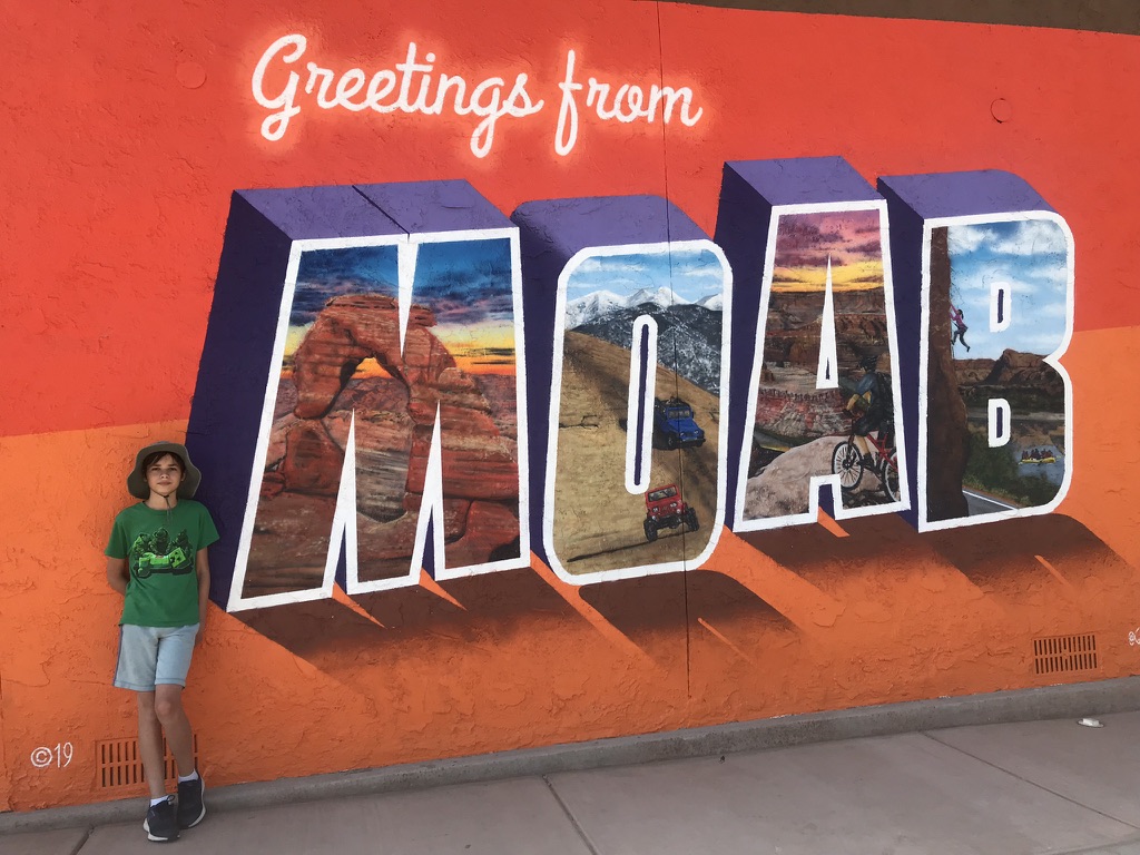
Very few places on the planet possess the magic and sheer magnificence of the red rock desert that surrounds Moab, Utah. One of the best ways to enjoy the beauty and grandeur of this outdoor mecca is to go hiking!
I feel quite fortunate, because I lived in Moab for 13 years and did my best to take advantage of the outdoor splendor nearly every single day. However, now I live in a big city (beautiful Portland, Oregon) so I recently made a trip back to Moab to visit this captivating community and to get out and hike all of my favorite hikes.
I had just one week, and a list of 10 hikes I wanted to tackle. Yet even though I am an avid hiker, I struggled to fit in more than one hike a day. In Moab, especially from spring until fall, I recommend getting up as early as possible to start your hike because the afternoons can get hot. Most trails feature little shade, and if you head out past noon, you will find yourself leaping from rock overhang to juniper shade to piñon shade and back again.
The first day I got up early and went for a hike in the morning, which I followed up with a hearty lunch. At this point, I was satiated and drowsy, and all I wanted was a good nap. Plus, it was the hottest part of the day; a terrible time to go for another hike. So that’s how it went each day: hike, lunch, nap, and then something low-key in the afternoon such as downtown shopping, community events or visiting with friends. It was the perfect itinerary for one week in Moab.
So what were my favorite hikes, and why did I choose them?
My objective for the week was to hike a variety of trails in the range from easy to moderate. Luckily, there are tons of hikes in the Moab area, and each one has its own unique characteristics. I also planned to skip Arches National Park, only because the park requires a time-entry permit during the busier times of the year, and I wanted to be flexible. Again, because I used to live in Moab I have been to Arches many times, so I decided to save those amazing hikes for a future trip.
Moab Hiking Tips
- Always bring plenty of water (1 gallon per person per day). Bring twice as much as you would bring at home if you are from a non-desert climate.
- Wear sturdy and appropriate footwear. Trail shoes are best for climbing over rocks and in dry environments. Hiking sandals are preferable when walking through creeks and sandy areas.
- Familiarize yourself with the local plant and animal life. Some organisms can be harmful such as poison ivy.
- Respect the land. Avoid walking on plants and cryptobiotic soil. Stick to rocks and sandy areas.
- In the hotter times of the year, hike early especially in areas with little to no shade.
1. Moonflower Canyon Trail (.6 mile out and back)
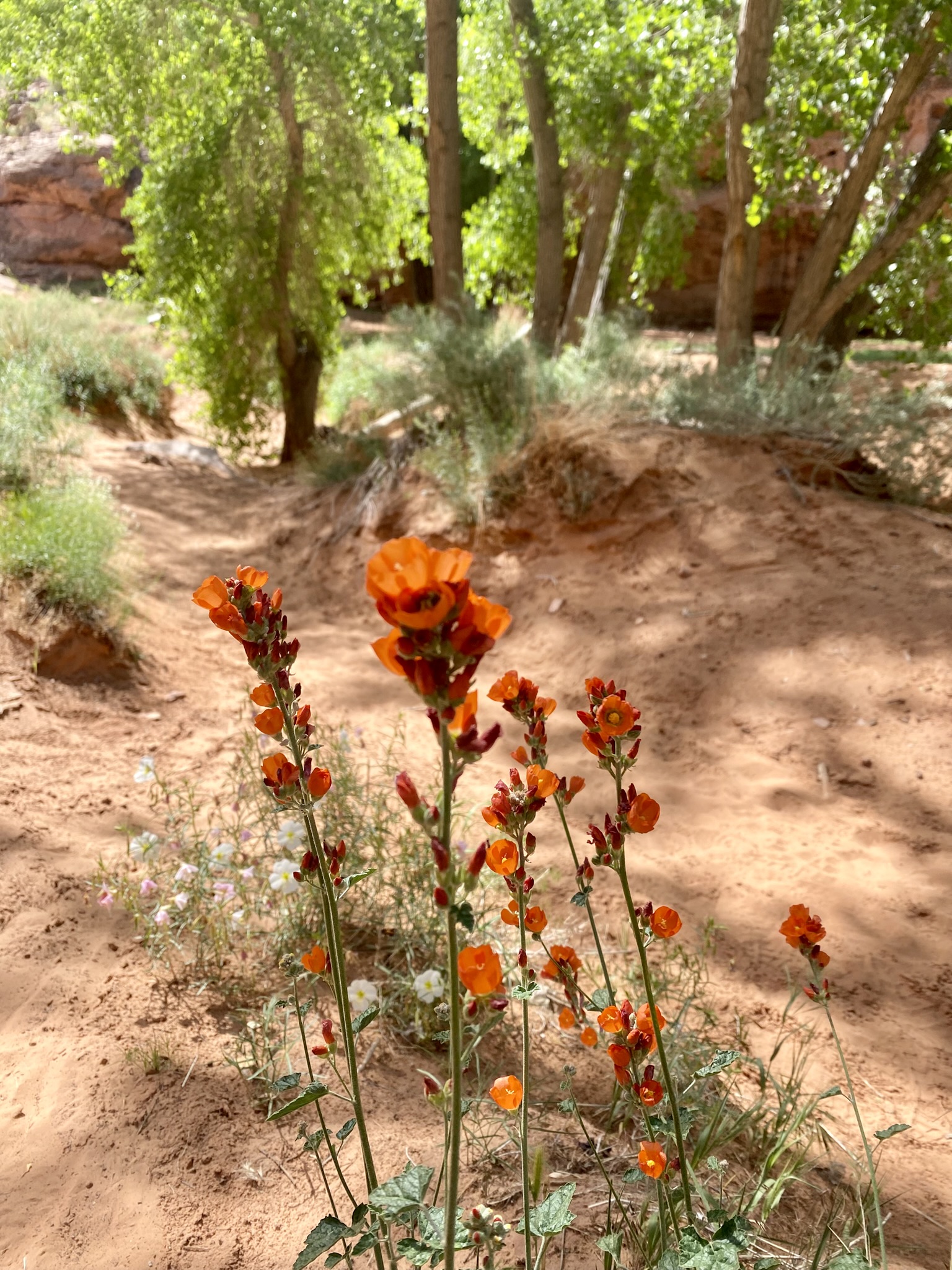
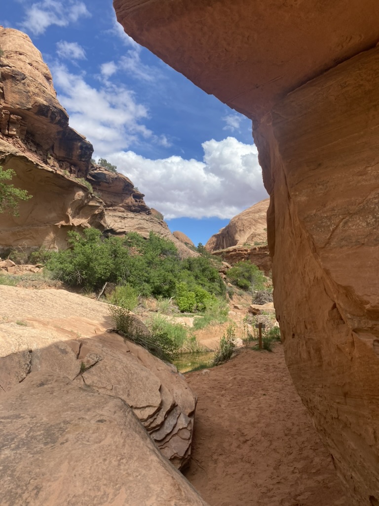
I started my week of hiking at delightful Moonflower Canyon with my friend Amber. The trail is short and easy, and located just 3.5 miles from Highway 191 along Kane Creek Road and the Colorado River. It’s a good starter hike to familiarize yourself with the Moab terrain and soak in the beauty of this magical place. The canyon is narrow with towering sandstone cliffs and thick, twisted cottonwoods which provide ample shade in this dry desert climate.
The trail is relatively flat and even, but sandy. The preferred footwear for hiking along Moab’s valleys and creeks are sandals, preferably those of the Chaco or Teva variety. I was happy in my Teva knock-offs, which are great in the sand and water but still have plenty of tread for making headway up sandstone boulders and inclines.
The only thing we had to watch out for on this beautiful spring day was poison ivy. In the late spring and into the summer months, poison ivy grows thick in Moab’s shady canyons, especially if there is water nearby. Most locals will leave the dogs at home when hiking through Moonflower or Grandstaff Canyon, because our furry friends can easily transfer the oil onto our skin with just one single pat on the head or scratch on the belly.
After about 10 minutes, we found ourselves at the end of the canyon surrounded by near vertical red rock cliffs with a small pool of water down below. The canyon felt secluded, like a hidden haven. The only sound was the quiet chatter of two young people perched on top of a huge boulder 30 feet above us.
My friend Amber pointed out a small trail that climbed up to a large overhang, and encouraged me to climb it. She alluded to the proximity of a natural spring pouring from the rock. I anxiously trudged ahead watching out for poison ivy and listening for the quick twitch of a rattler. I stepped gingerly up the rocky uneven slope, not yet acclimated to the terrain or the elevation. The view from up top was worth the climb, but I never did discover the natural spring, poison ivy, or a rattlesnake!
The way back out was quick. I remember this being a fantastic hike for my kids when they were young, or for visiting relatives who were not avid hikers. Or for friends who needed to take it easy.
Near the entrance of Moonflower Canyon is an added bonus: well-preserved petroglyphs and an Indian ladder. The petroglyphs are easily visible just to the right of the ladder, but the ladder itself is a bit challenging.

The ladder consists of several logs wedged into a crack in the rock that allow you to climb about 40 feet to the top. It helps to be both skinny and tall because the climb includes some tight spots you have to scramble up through, as well as some big stretches between ladder rungs. At 5’2″, I have yet to make it to the top!
If Moonflower Canyon isn’t enough for you, you can always stop and hike the Moab Rim Trail on the way back into town. This 8-mile out and back trail with an 1,880 foot elevation gain will have you huffing and puffing, and the views are absolutely spectacular!
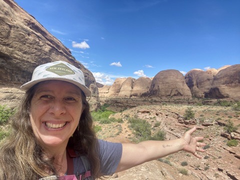
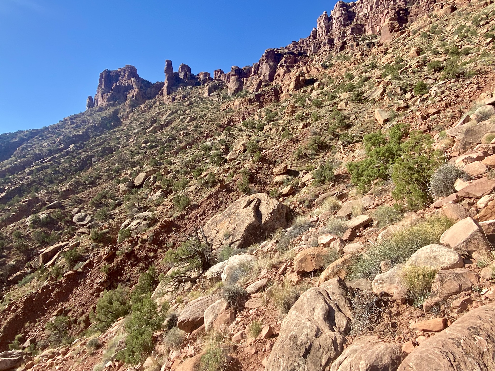
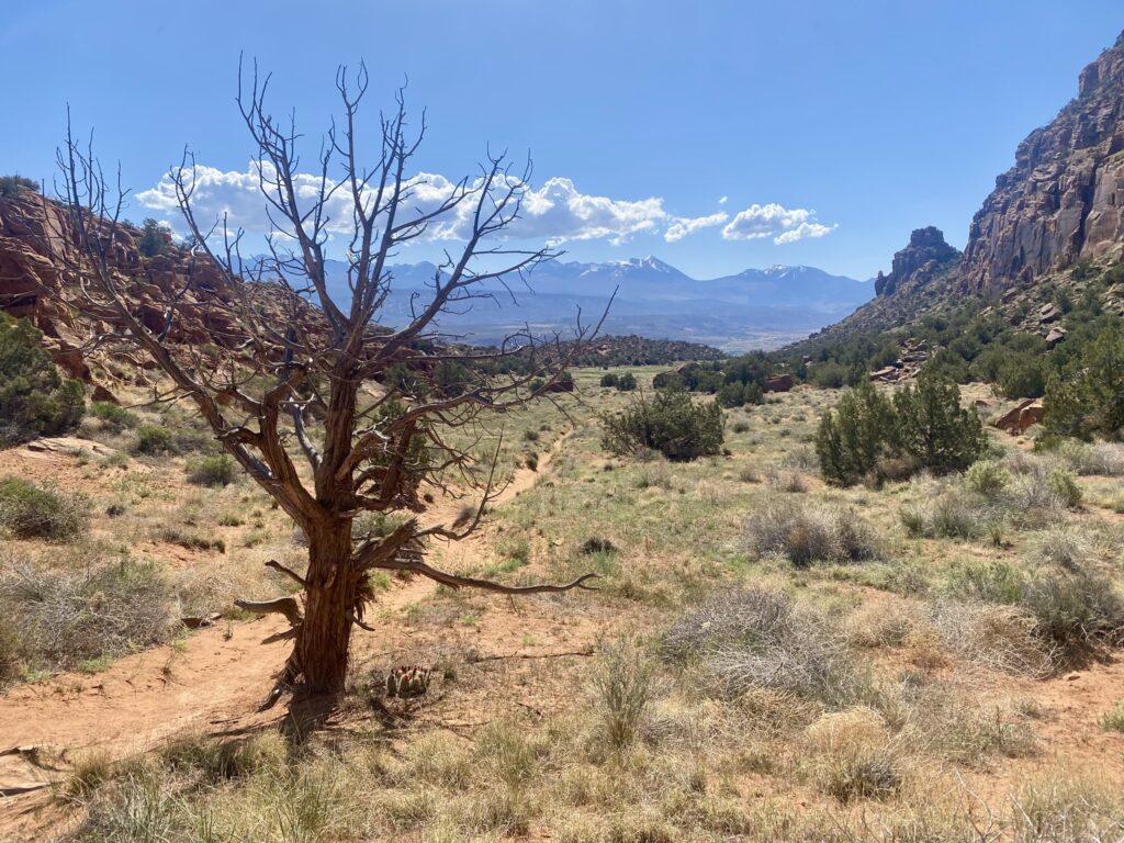
2. Juniper Trail Primitive Hiking Loop, Sand Flats Recreation Area (1.9 mile loop)
You can find another picturesque but relatively easy trail, the Juniper Trail, just 6 miles up Sand Flats Road from the Entrance station in the Sand Flats Recreation Area. The Sand Flats Recreation Area is a cornucopia of sandstone fins, domes, caves, and spires: a 9,000 acre desert wonderland. From the Juniper Trail, you also get unparalleled views of Arches National Park to the north and the La Sal Mountains to the southwest.
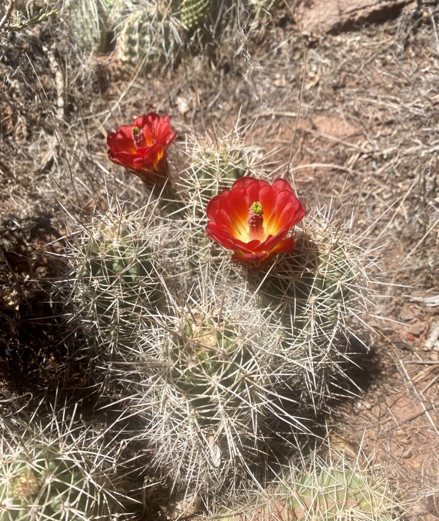
For this hike, I joined my good friend Uriia whom I have known for 25 years. On the drive up, we passed the famous Slickrock Bike Trail, and the Hells Revenge Jeep Trail. Moab is such a great place for all kinds of outdoor activities. Early May is an especially great time to be out and about recreating, because the temperatures aren’t too hot yet, and many of the plants and cacti are starting to bloom.
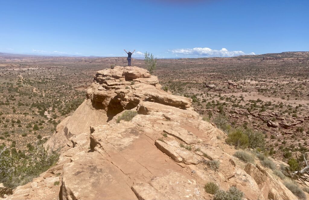
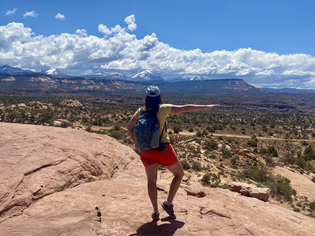
We reached the trail head for the Juniper Trail, parked, and then walked straight out to a stunning viewpoint high above the fins and canyons. I stepped carefully out on the ledge enjoying the rush of being present in such an invigorating and dramatic landscape. The view was impressive no matter which way we looked.
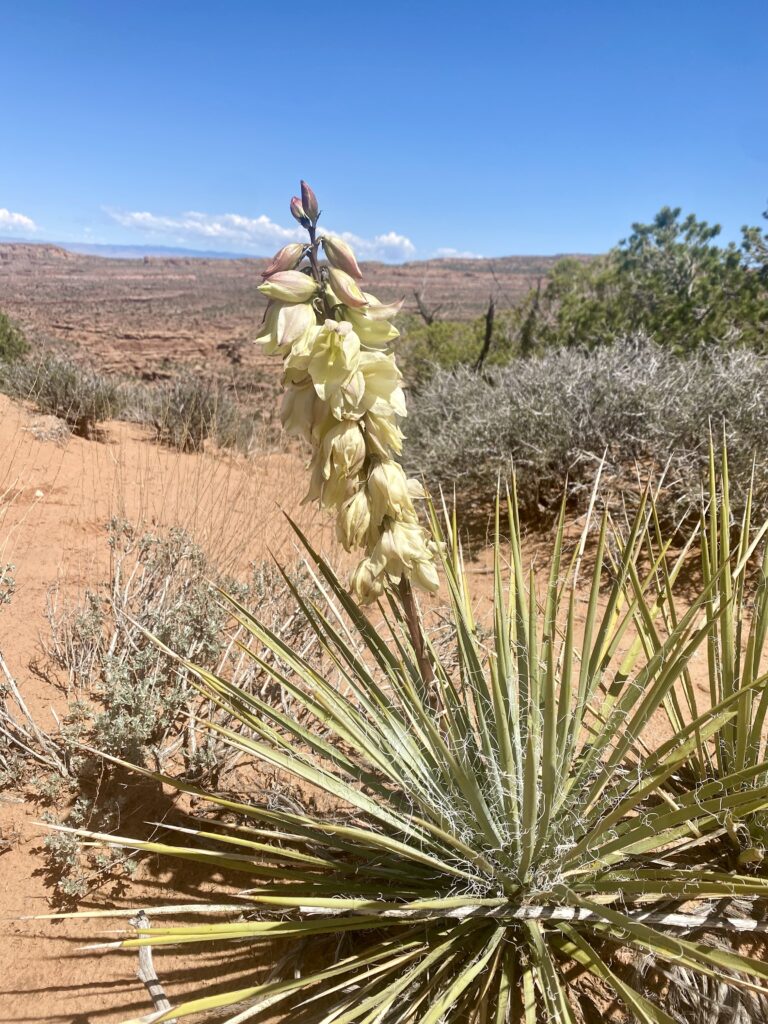
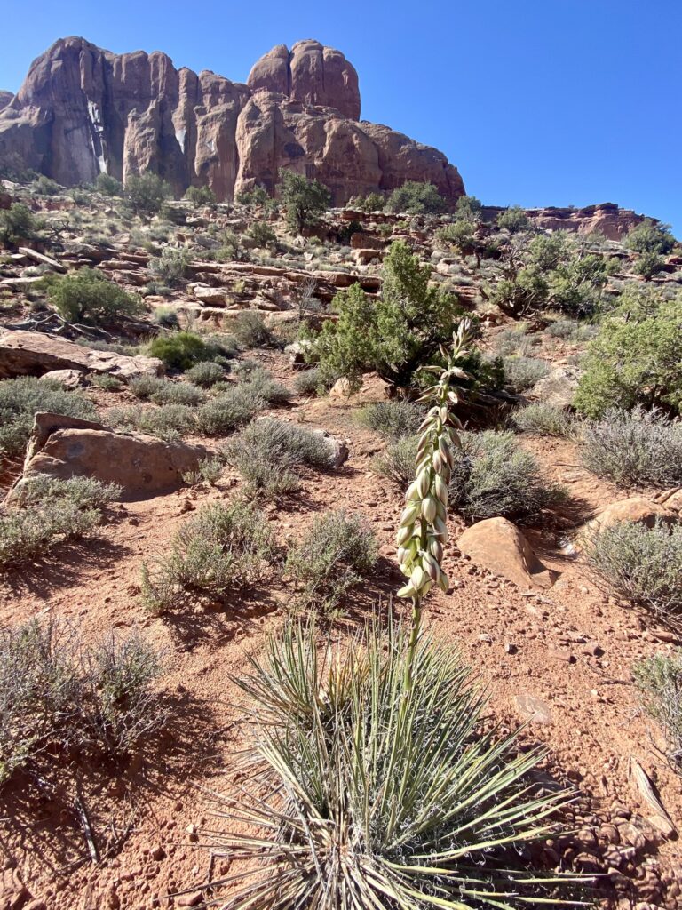
The Juniper Trail is mostly flat with just a short climb (100 feet) at the beginning before starting the loop. The trail follows along the edges of a small mesa with steep cliffs and spectacular views. We were cautious as we made our way along the loop, stopping occasionally to chat and just take in the beauty of this awe-inspiring place. Yucca and cactus flowers lined our path, while gnarly old junipers framed our views of the incredible desert terrain.
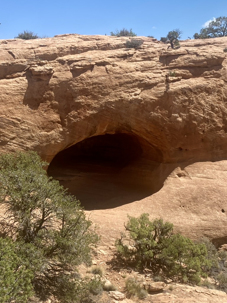
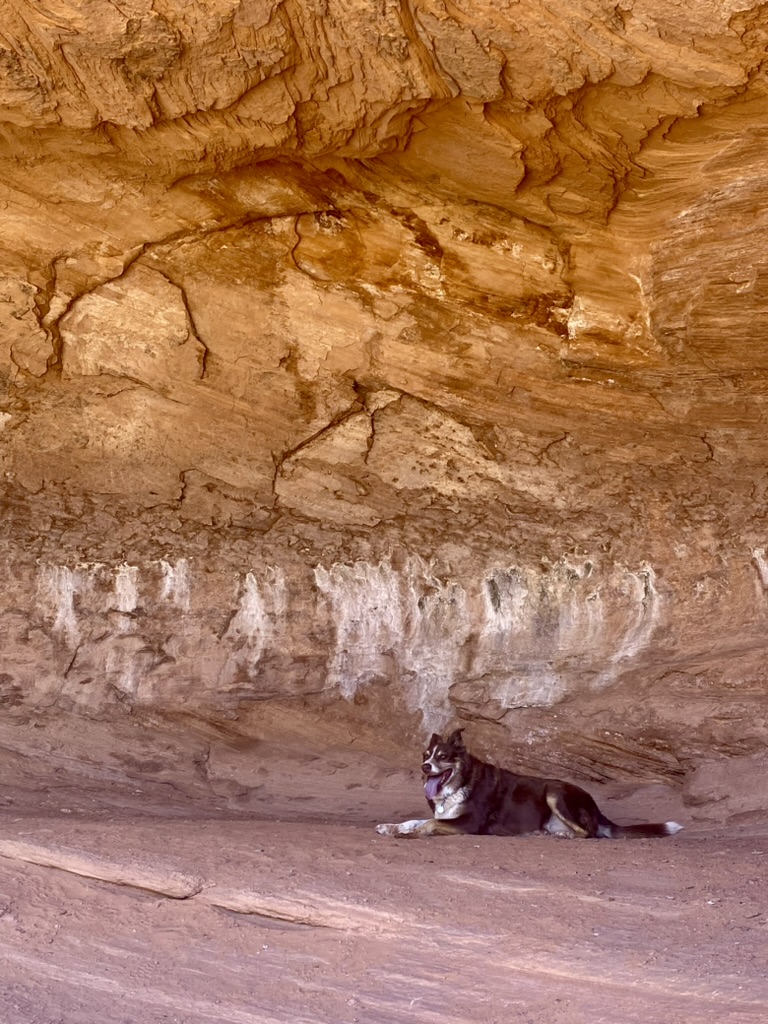
As we circled the mesa and neared the end of the loop, I spotted a cave down below. I wondered aloud whether there was a passable route to reach the cave, but then my friend’s dog, Lady, answered my question by running ahead of me and down the rock to the small canyon below.
We tentatively followed the dog, then clambered up inside the cave and rested in the cool shade. Lady took the prime spot in the upper part of the cave while I sat next to her peering out at the beauty of this desert paradise.
I have to say that one of the best parts of this trail was the solitude. We only saw one other group and they were just starting as we were leaving, so we pretty much had the trail all to ourselves.
Despite the popularity of Moab’s hiking and biking trails, it is still quite possible to find yourself isolated and alone, just one small speck in an expansive wilderness that stretches as far as the eye can see, and then some. Yet, this sense of loneliness is not negative. It is rejuvenating and peaceful. Our hearts were full and our energy restored as we made our way back to the car.
After the Juniper hike, I suggest stopping at Milt’s Stop & Eat for burgers and a milkshake. Milt’s originally opened in 1954 at the corner of Millcreek Drive and 400E and is considered a Moab staple. There are even options for vegetarians (like me). Ask for the vegetarian patty melt. It was not on the physical menu but I saw it mentioned online. It was delicious!
FYI the Juniper Trail has no water and very little shade so prepare accordingly.
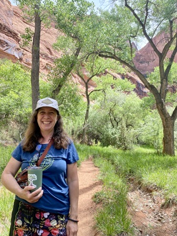
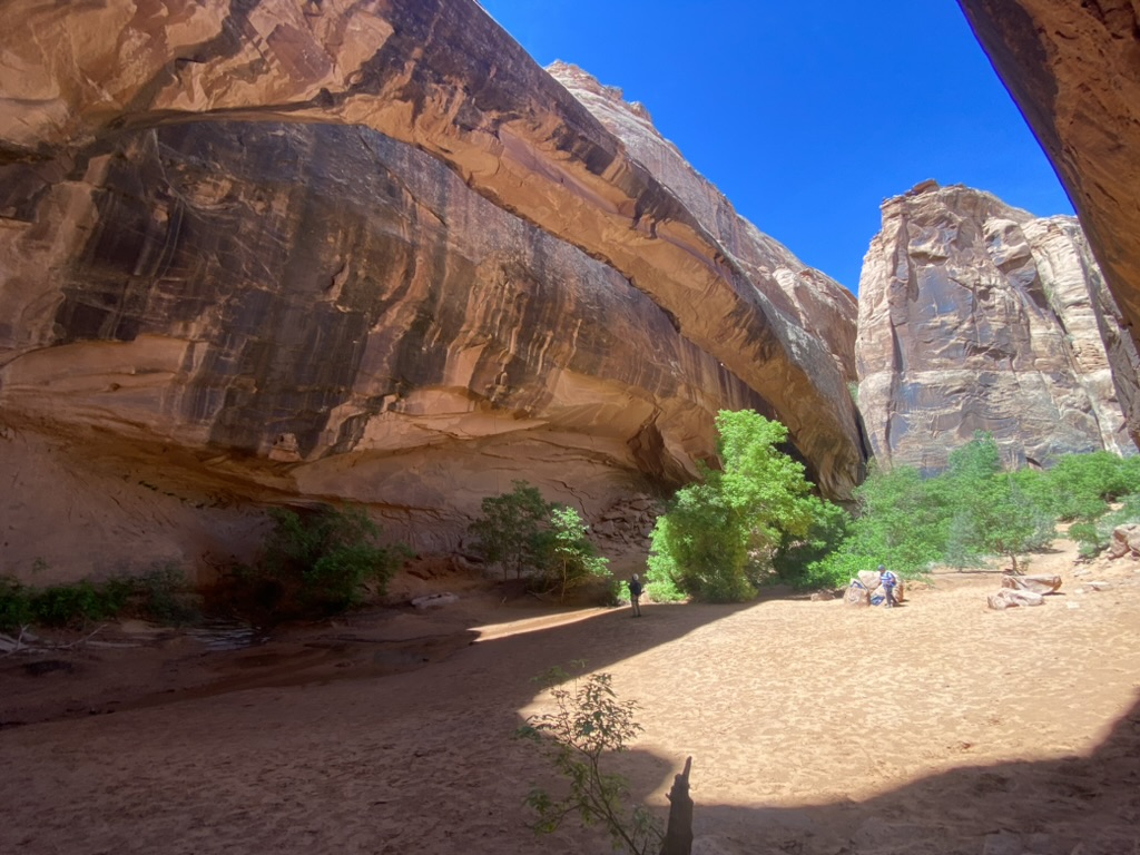
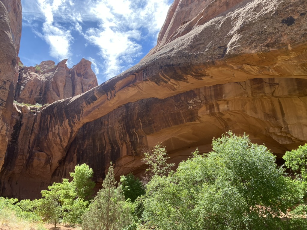
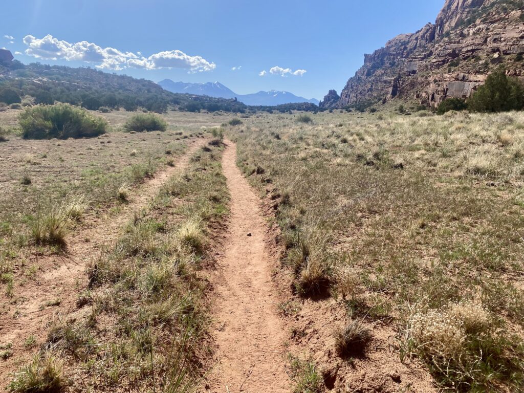
3. Grandstaff Canyon (4.4 miles out and back to Morning Glory Arch)
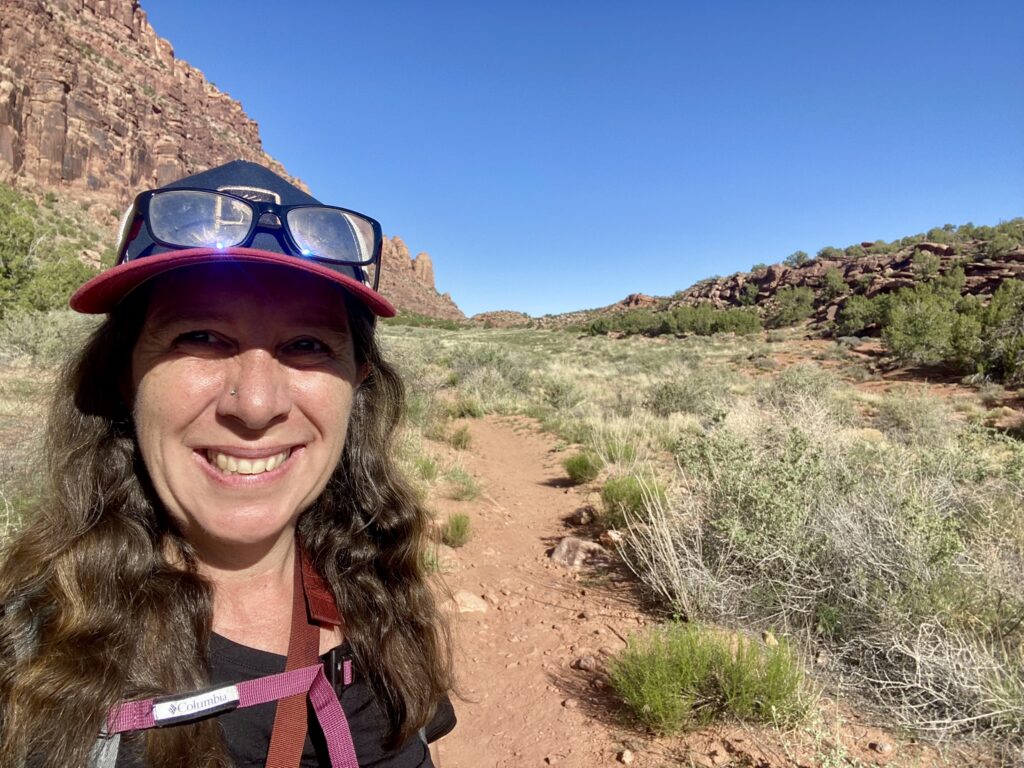
I was excited to get up early and hike my first solo trail of the week. Grandstaff Canyon is an extremely popular hike and the parking lot can fill up quickly, so it is best to get there as early as possible.
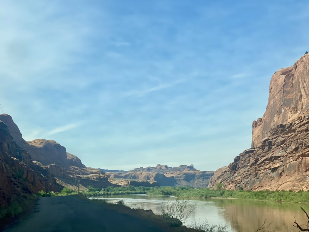
I didn’t make it until 10am, because I made my first stop at Moonflower Market for a leisurely coffee date with a local friend I had met on the Camino de Santiago last November. We chatted for an hour about future Caminos before I made my way up Highway 191, and then turned right onto the Colorado River Road (SR-128) for 3.1 miles to the trailhead.
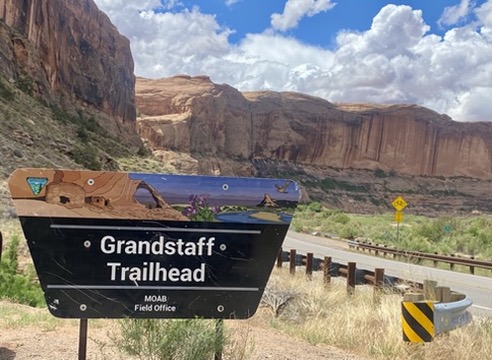
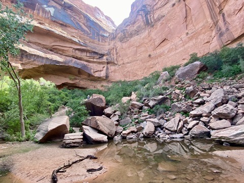
Because Grandstaff Canyon is just 10 minutes from town and considered only moderately challenging, the trail is a favorite among visitors. Along the route, hikers can experience lofty sandstone cliffs, shady clusters of cottonwood and willow trees and multiple creek crossings. Water, sand, rock and sky: it’s what makes the Moab desert so beautiful. The trail ends at majestic Morning Glory Arch, the sixth largest natural bridge in the United States.
I arrived at the trailhead just a little too late (10:10am) and the parking lot was full. Luckily there was another almost empty parking lot across the highway. I found a vacant spot and then made my way safely across the road before embarking on the trail.
Grandstaff Canyon was named in honor of William Grandstaff, a Creole-African American pioneer who settled in the canyon from 1877 to 1881. In 1881, after a Native American uprising, he abandoned his home and 40 head of cattle before turning up again in Glenwood Springs, Colorado. Locals still refer to the canyon as Negro Bill Canyon, but the name was officially changed in 2015 to respect Grandstaff’s vital role in early Moab history.
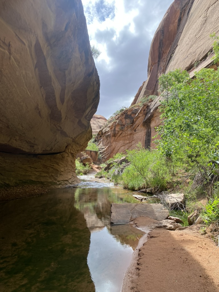
As I headed out on the trail, I was mesmerized by the splendid scenery that surrounded me. The ocherous red sand was warm beneath my feet. Graceful sandstone boulders and cliffs contrasted with the green hues of spring leaves and the perennial stream that cuts through the canyon. All of these features create a welcoming space to frolic and revel in the beauty of nature.
Although some accounts refer to Grandstaff Canyon as moderately challenging, I found it fairly easy and definitely delightful. There are a few segments where the trail had been washed out and I had to detour up some steeper inclines, but much of it follows right along the stream. Be prepared for multiple water crossings. I wore my trail runners and was able to hop across the rocks without getting my feet wet, but hiking sandals would also be appropriate.
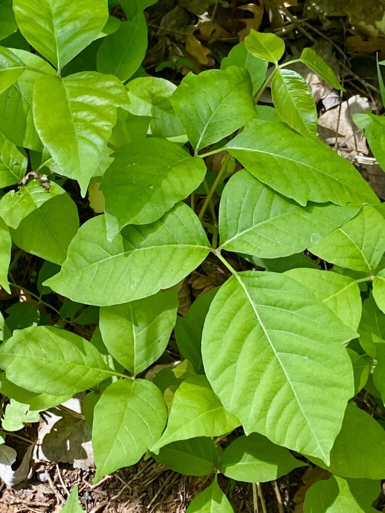
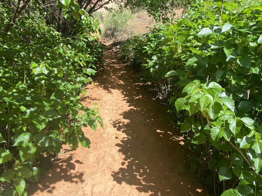
The biggest concern for hikers in spring and summer is the plethora of poison ivy along the trail. Many locals avoid taking their pets in this canyon (and Moonflower) because of the overabundance of this noxious plant. Learn to recognize poison ivy before heading out on this trail or any other stream-lined canyons. Just before Morning Glory Arch, I found myself walking through a thiicket of poison ivy that reached out onto the trail on both sides, so be cautious!
After hiking 2.2 miles the trail ends at the phenomenal Morning Glory Arch. I had great timing because just before the end I passed a large group of middle schoolers on their way back to the parking lot. For a few moments, I had the arch all to myself.
Morning Glory Arch spans 243 feet and is considered one of the largest natural arches in the world. After admiring the vastness and impressiveness of this arch, I found a good spot in the shade to sit and enjoy my lunch.
Not long after I took my first bite, I realized I was not alone. Up on the side of the rock under the arch I saw something moving. As the small dark figure descended slowly down the rock face, I realized it was someone rappelling.
Once the person reached the bottom they looked up, and I saw yet another person making their way down the rock. I waved and asked them about their trip. “Not too bad,” one said. “Slow and steady,” said another. Hmmm, maybe I will try it someday. Sounds like another great adventure!
At last, I made my way back out and to the parking lot. The hike back was quick (and slightly downhill). The parking lot was much emptier than when I started. The entire adventure took me about 2 hours and 20 minutes. I would recommend Grandstaff Canyon as an enjoyable and relaxing family-friendly hike.
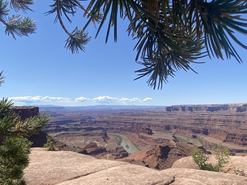
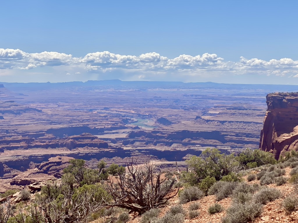
4. Dead Horse Point State Park West to East Rim Trail (5 mile loop)
After living in Moab for 13 years, I realized that I had never been to Dead Horse Point State Park so I was determined to finally check it out. One of the reasons I had never gone was the cost, a $10 fee 15 years ago. I could never justify it because there were so many free places to hike in the Moab area (and I was young and poor).
Well in 2025 you will pay $20 per vehicle for a day use fee, and it was completely worth it. An added bonus: because it is a state park you can also bring your dog, which you cannot do at Arches or Canyonlands National Parks.
For this hike, we loaded up the car with myself, my friend Uriia and her sister Coya, along with their two dogs and a cooler full of food. The park is located just 30 miles from Moab. Head north on 191 for 11 miles then take the turnoff onto UT-313 west to reach the entrance to the park.
We left around 9am hoping to get somewhat of an early start. The morning was already feeling a little warm so we rolled down the windows and admired the incredible landscape as we sped on by.
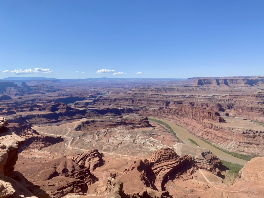
Dead Horse Point State Park is known for its spectacular overlook over the Colorado River and Canyonlands National Park. The park was created in 1959 but legend claims it was named for a group of cowboys who drove a herd of wild horses onto the point and trapped them there. The horses became manic from heat, thirst and exhaustion and eventually perished from exposure. Some believe the horses can still be heard roaming around the area. This is also where they filmed the famous scene from Thelma and Louise where they drive off the cliff.
For this adventure, we decided to hike the Rim Trail from the West Rim to the East Rim, basically a loop. We drove to the parking lot for the famous overlook and started hiking from there. The combined Rim Trail is a 5-mile loop, and features multiple amazing viewpoints of the canyons below.
The terrain is fairly easy without much elevation change, although you are already hiking at around 5,900 feet. There is little to no shade along this trail. Water is only available at the main viewpoint and the Visitor’s Center, so make sure you bring plenty of fluids, snacks and a hat!
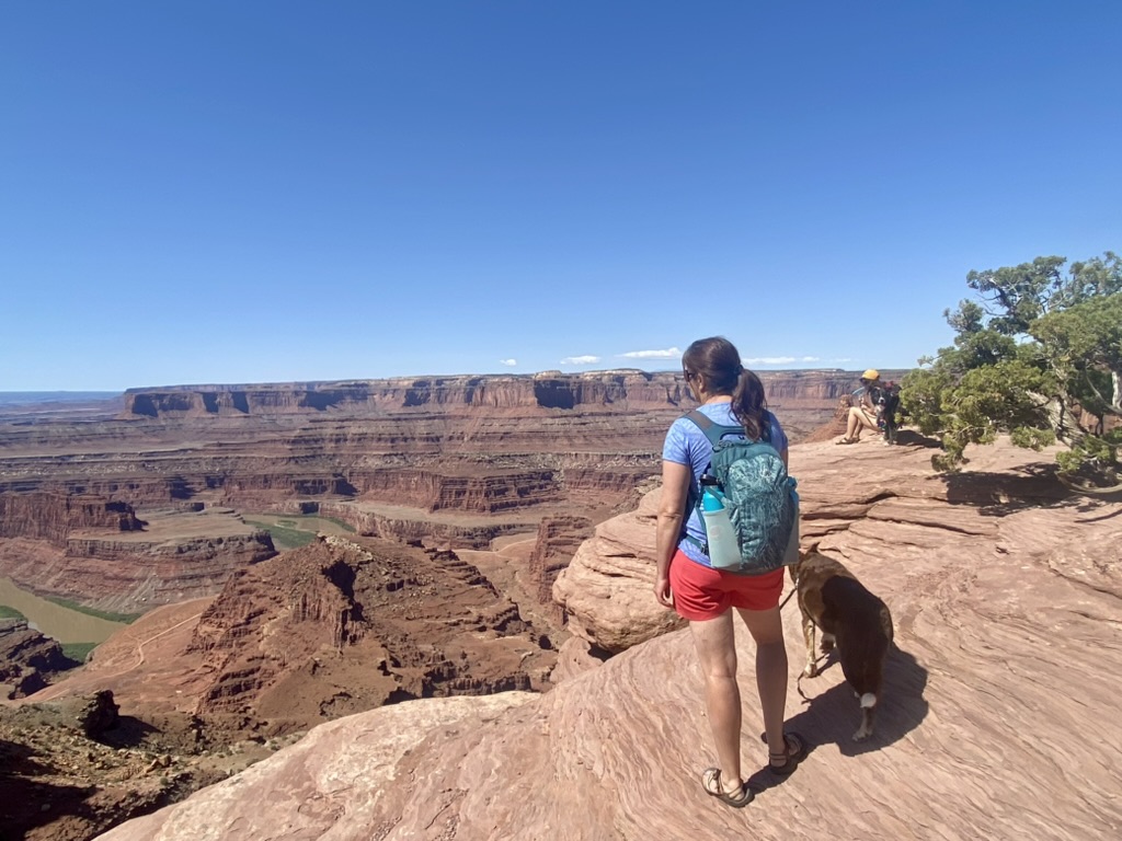
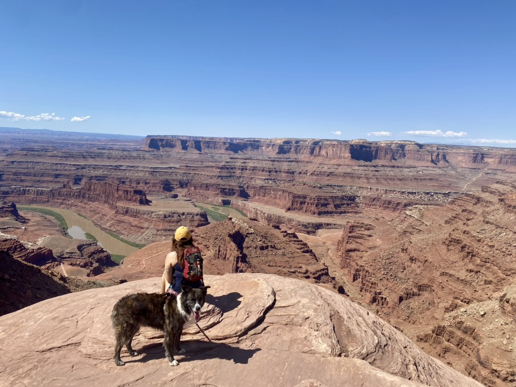
We started out on the West Rim. The trail frequently skirts the edge of the cliff with breathtaking views of the canyons and the Colorado River 2,000 feet below. We walked at a leisurely pace taking frequent breaks in the shade in order to give the dogs a chance to get out of the sun. The temperature was comfortable, maybe 75 or 80°F, but the desert sun is still brutal and the sand can be hot on a dog’s feet.
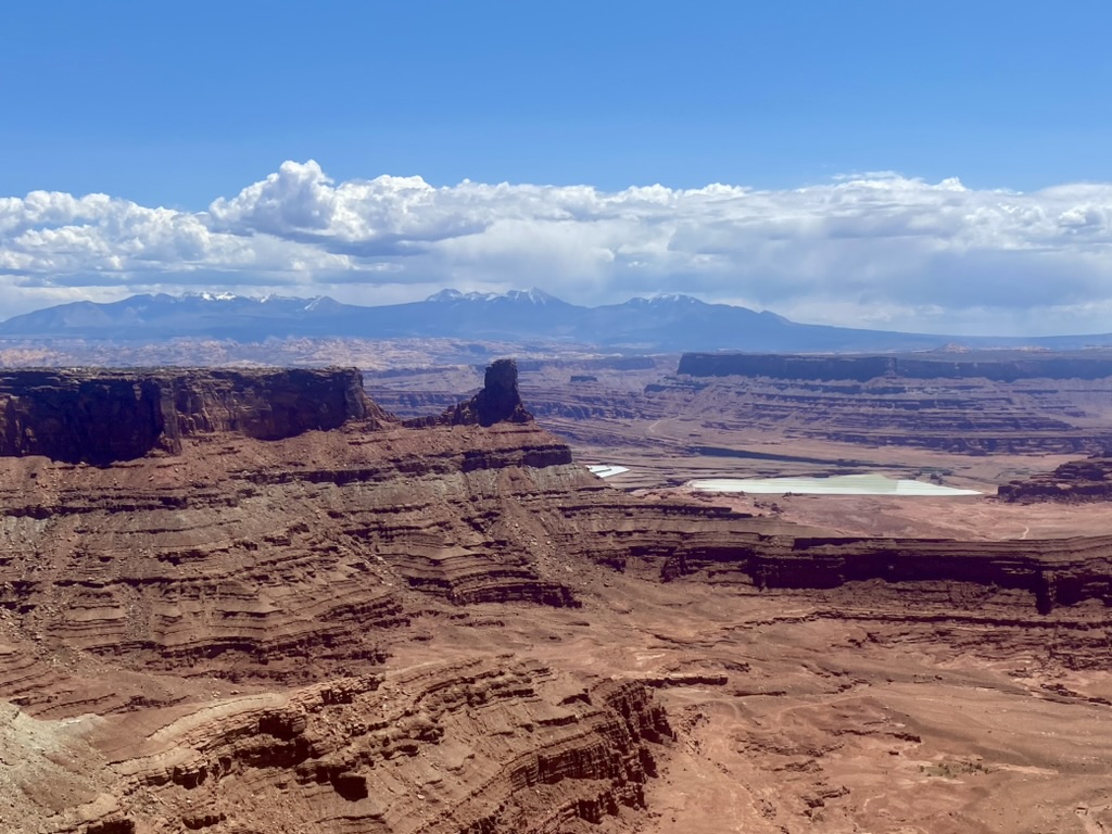
Eventually we reached the Visitor’s Center, which marked the halfway point for us, and the start of the East Rim Trail. The East Rim Trail is much more traveled than the West Rim, and we probably saw double the number of people. As we moved into the afternoon, the sun rose higher and higher in the sky and began zapping our energy.
The views from the East Rim were still spectacular but somewhat marred by the artificial blue potash evaporation ponds down below. The potash minerals were deposited around 300 million years ago, and have been actively mined since the ’60’s.
At long last we made it back to the car and a cooler full of food and cold drinks. Not far from the parking lot we discovered several covered picnic areas and found a good spot to set up our spread. Lunch was tortilla wraps with fresh veggies and hummus, accompanied by chips. Worn out but content we climbed back into the car and made our way back to Moab. Bucket list accomplished.
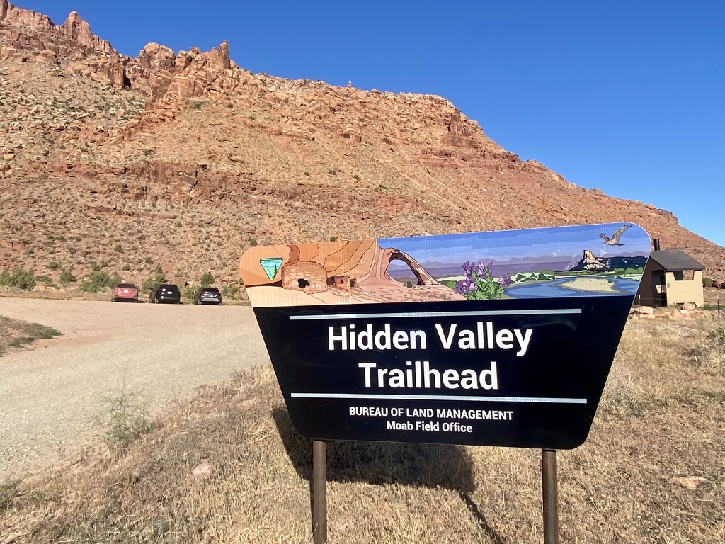
5. Hidden Valley Trail (6 miles out and back to Moab Rim Jeep Trail)
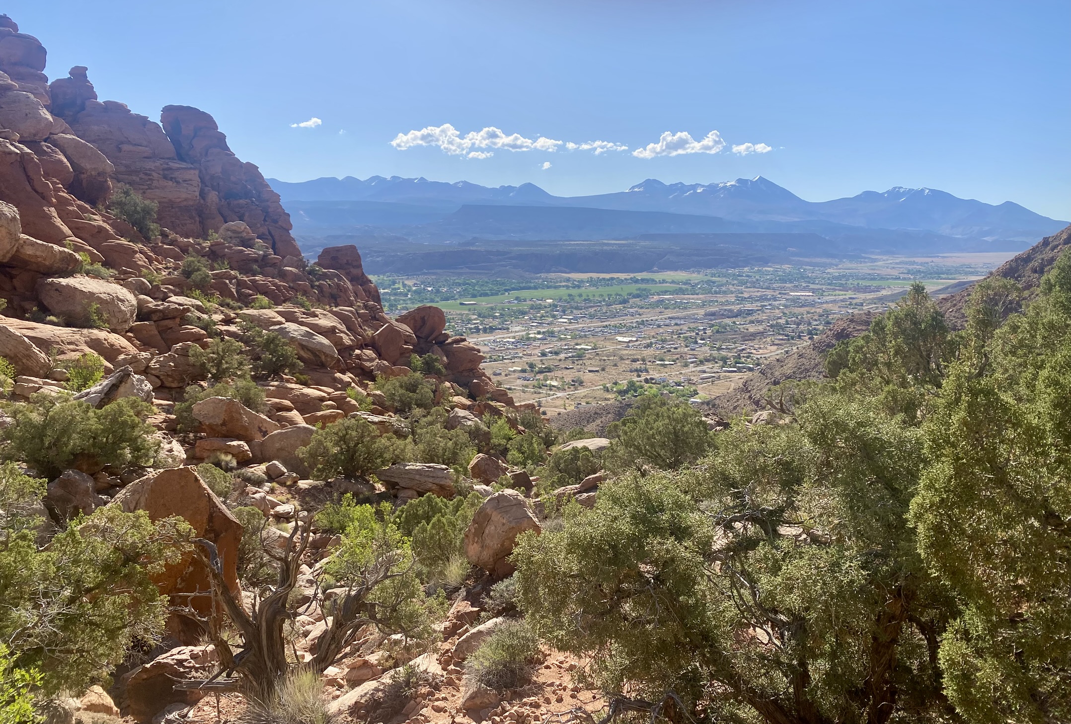
On my last full day in Moab, I committed myself to getting up early and hiking the Hidden Valley Trail, despite the late night out before at the only dive bar left in Moab, Woody’s Tavern. I drug myself out of bed around 7am. Hidden Valley had always been one of my favorite hikes in Moab, and I knew it was a tough one, but I was up for the challenge.
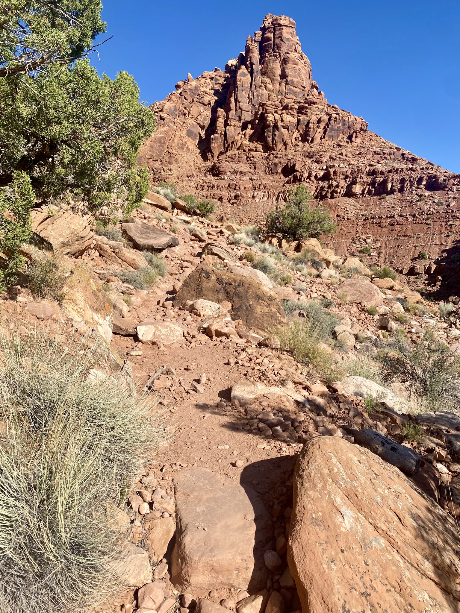
The first 1.5 miles of the trail climbs 550 feet via steep and rocky switchbacks that culminate in a lovely “hidden” valley, a wide stretch of grassy fields bound by towering sandstone walls. One moment I was gasping up the steep incline trying to locate an often indiscernible trail. The next moment I was walking through a pleasant valley with a mostly straight path stretching far into the distance.
Punches of wispy yellow herbage and colorful desert flowers added contrast to the sea of green pasture. I put my headphones in and just walked listening to my latest inspiring audiobook and breathing in the pure beauty of this wonderland.
I saw few people. Occasionally I would meet up with someone walking in the opposite direction, and we performed the standard hiker greeting “good day for it”. I came to what I thought was the end of the valley but it was only an upraised section of the land with a few lonely rock formations. The valley continued for at least another mile on the other side.
At nearly 3 miles in, the terrain finally began to change. The trail left the grassy fields and climbed up over slabs of sandstone framed by towering cliffs and punctured by the occasional cave. Huge boulders littered the path as it dropped down into a magnificent canyon and the start of the Moab Rim Jeep Trail. It is possible to continue to the Rim Trail and finish the hike out the other side by Kane Creek Road, but I was hiking alone and didn’t want to go to the trouble of finding a ride back to my car.
The sun glared down at me as I made my way back. It was only 9:30am but I was starting to cook. Today’s high was forecasted in the upper 80’s. I already felt much too hot. I didn’t pack enough water, and there was no shade. I walked fast across the beautiful hidden valley trying to take it all in while trying not to think about being thirsty.
I reached the end of the valley and made the steep descent to the bottom. I attempted to be cautious with my steps but I still slipped a few times. This rocky terrain can be dangerous if you go too fast, an ankle breaker.
As I neared the end, I was hot and sweaty even going down. And yet, some people were just starting the trail at 10:30 am. The cooler early morning air had vanished and I thought to warn them but they were too excited, too anxious. “Have a great hike”, one person shouted to me, even though I am just finishing up. I gratefully climbed into the air conditioned car and headed the 5 minutes back to town for a long refreshing drink of water.
Moab Fun Facts
- Moab is the largest city in Grand County with a current population of 5,127 (2025). The population has changed very little in the last 25 years.
- Moab is designated as a Dark Sky Community because of its minimal amount of light pollution. Therefore it is a popular place for star gazing.
- Moab was once known as the Uranium Capital of the World. In the 1950’s, Geologist Charlie Steen discovered a rich uranium deposit which led to a population explosion and rapid development of the town. By the 1980’s the uranium boom had ended and the town’s population plummeted.
- Moab is a popular filming site for movies. Some of the classics include: Wagonmaster (1949), Rio Grande (1950), Space Hunter (1982), Indiana Jones and the Last Crusade (1989), Thelma and Louise (1990), City Slickers II (1993), Con Air (1996), Galaxy Quest (1998), Mission Impossible II (1999), Austin Powers III: Goldmember (2002), Star Trek (2009), 127 Hours (2010), John Carter of Mars (2010), The Lone Ranger (2013), and After Earth (2013).
- Moab is considered an outdoor mecca. People come from all over the world to enjoy some of the best mountain biking, hiking, rafting, and rock climbing on the planet.
Leave a reply